WWW.PHILLYH2O.ORG
ALL
IMAGES COPYRIGHT.
See Main Page of this Collection for More
Information on Rights and Reproductions.
CLICK IMAGE TO RETURN TO THUMBNAILS
Lithograph
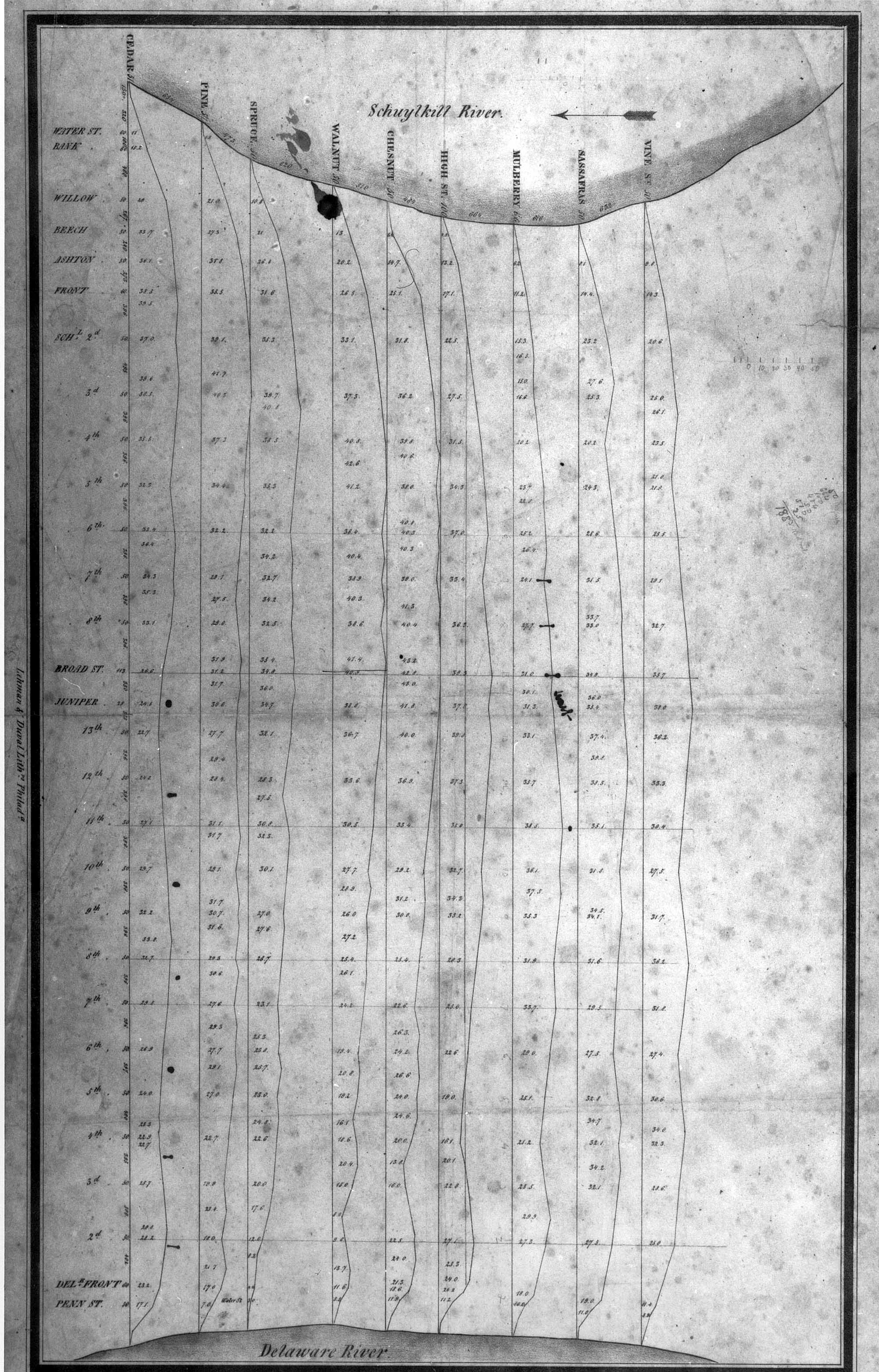
Plan showing elevation profiles along the major streets of Philadelphia, between
Vine and South streets, and the Schuylkill to Delaware rivers.
Probably used by Frederic Graff, in designing the water distribution system from Fairmount. Ca. 1810. Lehman & Duval, Lithographers. Graff Collection GRII-7, Franklin Institute.
Probably used by Frederic Graff, in designing the water distribution system from Fairmount. Ca. 1810. Lehman & Duval, Lithographers. Graff Collection GRII-7, Franklin Institute.
PREVIOUS IMAGE
NEXT IMAGE
GRII_7_ELEV.jpg
629.83 KB